Rocky Mountain Philatelic Library

Where would a person look for a 1940s road guide to the British Isles, detailed maps of Taiwan of the early 1900s or a railroad valuation map of Oakes, Colorado? Start in the map room!
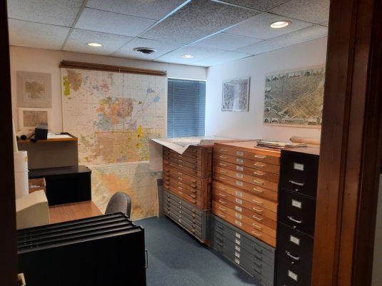
There was a time when the library’s map collection was only a couple of file drawers, initially organized by Bill Dunn, and which included mostly maps from gas stations and National Geographic. Through the generous donations of maps and map cabinets the collection has steadily grown and now occupies its own room, located in the north end of our annex building at 7070 East Asbury. The collection has been reorganized and is again available for use.
The collection exists in two forms: flat maps in large, specially sized, wide and shallow map drawers, and folded maps in filing cabinets. Both are organized in easily recognizable and understandable categories ranging from the entire world and regions to countries, cities and towns.
This new sorted arrangement enables a researcher to quickly find the area of interest. The collections of maps for Colorado and California are substantial. Within Colorado, selections are: region, county and city, highway and even National Parks and Forests.
The following samples are types of maps most commonly used while researching in the map room:
Topographic maps: are useful in studying the area around a town site, mine or region, or just determining the “lay of the land”. Sure, topographical maps are available online, but those are usually the most recent editions and our collection has older maps dating to the early 1900s. Studying old maps for an area of interest may help to understand the political changes and history of an area.
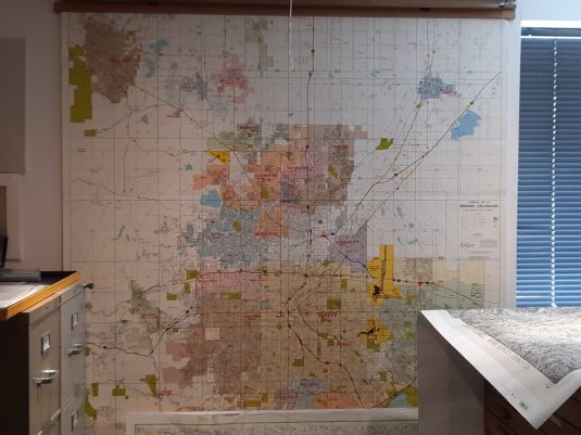
Historical maps: Mainly of Colorado, show the locations of early settlements, trails and wagon roads. Some of these early roads have familiar names which we recognize today as major highways.
Railroad maps: Many from Colorado and other nearby areas, show the locations of long-since-gone railroads and towns. We also have Colorado railroad valuation maps on microfilm.
Other not-so-common maps are:
Outline maps: Simple outlines of countries and U.S. states and are useful as visual aids for specialty collections or exhibits to illustrate the location of a specific town or area.
Pioneer trails: Have you ever wondered about the exact locations of the Oregon Trail, the Santa Fe Trail or what the areas are like today? These famous trails passed through or near Colorado, and each one has its own book.
USPOD Post Routes, Railroad and Related Maps: Use these to determine the route or method a particular piece of mail traveled. The RMPL’s Post Route maps collection is far from complete but does contain several maps of Colorado and the surrounding states from different periods.
And some of our maps are out of this world! Yes, we have maps of the Solar System, the Milky Way, even the Universe. We even have maps of the unseen world: the depths of the oceans. General world atlases of a wide range of years are found in the main book collection in the main library building, but there are two books there that are also in the map room that are excellent starting places:
Where in the World? is logically arranged by continent, country and then time frame.
The Stamp Atlas is also very helpful with research. Of the six sections in this book, the ones of most use are Section One, “Gazetteer of the Philatelic World Since 1840”; Section Two, maps of “dead” countries; and Section Three, maps of current stamp-issuing entities. Section Two is the largest of any section in this book and contains not only “dead” countries but also occupied lands and Confederate states. (RMPL call numbers 912 Wel and 912 Woo).
You’re welcome to visit and browse the map room anytime.